Transit · Oct 10 – Oct 10 2024
This single-signal cluster documents month seven of rswfire's RV life as a morning transit south, then north — a fuel stop at 6:00 AM with roughly 100 miles remaining, descending from over 1,200 feet toward sea level, and arriving at a campground eight miles inland on the southern Oregon coast.
The dominant pattern is route as decision record. rswfire revises an earlier intention to continue north, stating a plan to winter in the area for possibly a couple of months and head north in spring. He names what the ground offers: hiking, foraging, storm watching, and scenic driving in the Jeep.
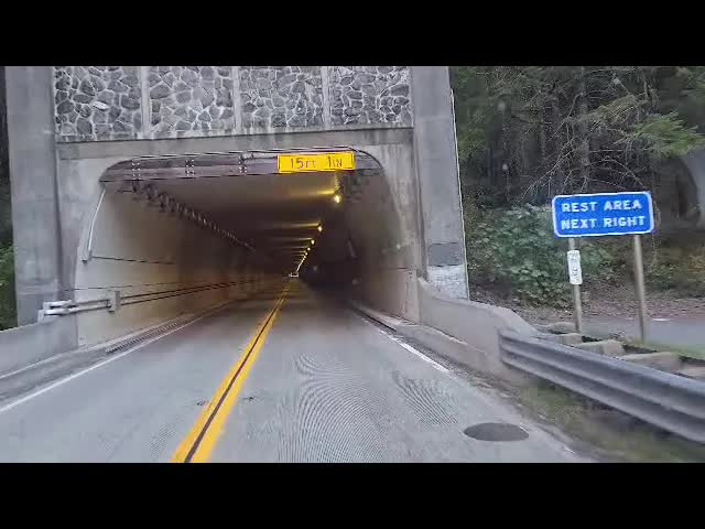
The corridor itself is federal and interstate — Wild Rivers Ranger Station, a brief stretch of California, his first tunnel in the RV, Smith River National Recreation Area, Six Rivers National Forest, Panther Flat Campground, Redwood National and State Parks — before US 101 and the Oregon border.
Logistics run alongside the drive rather than beneath it:
- a routing dispute with the Garmin over a preferred river road
- an inverter pickup Saturday requiring a return trip by Jeep
- a state park declined for lack of availability and close site spacing
The signal closes with camp set for two weeks, firewood to buy, and Rangers met. Continuous elevation and temperature tracking runs the length of the transmission — orientation held by instrument as much as by intention.
Transmissions (1)
rswfire documents the final leg of a drive to the **southern Oregon coast**, beginning with a 6:00 AM fuel stop and continuing roughly 100 miles toward **Brookings** and Highway 101. He states his plan: stay about **8 miles inland for possibly a couple of months**, wintering in the area with hiking, foraging, storm watching, and scenic Jeep drives, then potentially heading north in spring. The route crosses briefly into **California**, through his **first tunnel in the RV**, the **Smith River National Recreation Area**, and **Redwood National and State Parks**, with steep downhill grades and dropping elevation he tracks toward sea level. He notes van lifers, ranger stations, burned areas, and old-growth trees along the way. Key route facts: - The **Green Road** — a green line on his GPS, a forest service road along a river he wanted to take — was bypassed by the Garmin's routing, and he could not get back to it. The disappointment stayed with him through the recording; he later called missing that road the most memorable part of the journey. - An **inverter delivery to Medford** would arrive after he passed through, requiring a later backtrack in the Jeep — which became his opportunity to finally drive the Green Road. He describes a **full-body experience** approaching the Pacific, catches glimpses of waves and coastal rock, crosses back into Oregon, and sets up camp for **two weeks**, noting pleasant rangers and much to explore.
Cluster Analysis
Substrate
Tags
Dominant Language
Entities
Actions
Performed
- • stopping for fuel at a truck stop at 6:00 AM
- • driving the RV roughly 100 miles to the coast
- • narrating the winter plan to camera mid-transit
- • tracking elevation readings aloud toward sea level
- • descending a 6% grade and managing gears
- • crossing into California and back into Oregon
- • driving the first tunnel in the RV
- • reading and naming Forest Service and park signage
- • disputing the Garmin's routing
- • scanning the roadside for first ocean sightline
- • registering cold ocean air and full-body response
- • setting up camp for two weeks
Referenced
- • adapting to RV life over seven months
- • visiting lakes repeatedly and being mesmerized by water
- • declining a state park for lack of availability and close site spacing
- • meeting Rangers at the campground
- • ordering an inverter unavailable until Saturday
- • an earlier intention to continue north, since revised
Planned
- • wintering on the southern Oregon coast
- • heading north in spring
- • retrieving the inverter by Jeep on Saturday
- • unloading the Jeep and driving to the ocean
- • hiking, foraging, and storm watching
- • walking the Oregon Redwoods trail about a mile from camp
- • returning to Panther Flat and the Smith River area by Jeep
- • buying and gathering firewood, building a campfire
- • driving scenic routes in the Jeep
- • staying two weeks with duration open after that
- • possibly taking up surfing
Symbolic Elements
Ontological States
-
•
sovereign (route, duration, and wintering ground chosen in transit rather than assigned)
-
•
transitional (in motion between interior elevation and coastal sea level; state not yet arrived)
-
•
embodied (approach registered as a full-body event — cold air, ears clearing, felt before seen)
-
•
open-ended (two weeks stated with duration after that held as position, not gap)
Subsystems
-
•
navigational (continuous tracking of elevation, mileage, signage, and contested GPS routing)
-
•
somatic (full-body registration at the ranger station, cold air, ears clearing, temperature)
-
•
mechanical (gear management on 6% grade, tunnel clearance, inverter logistics)
-
•
ecological (tree species, forest units, fire scars, rivers, and coastal fog assessed in passing)
-
•
logistical (campground availability, two-week booking, Jeep retrieval run, firewood)
-
•
aesthetic (stated preference for uncrowded ground; rejection of packed state park and roadside spectacle)
-
•
intuitive (states his pull toward water and the ocean as a directional instrument)
NARRATIVE
The drive that began at a truck stop at six in the morning was supposed to be a leg. rswfire had been going north — that was the standing intention, the direction the seven months had been pointed. What he came down out of the mountains with, a hundred miles later, was a different plan entirely: eight miles inland, a couple of months, spring for the north. The drive did not deliver him to a waypoint. It converted him.
The mechanism was the descent. He tracked elevation the whole way down, calling it out as it fell from over twelve hundred feet toward sea level, temperature at fifty, fog in the low places. That running instrument read is not incidental to the decision — it is the decision being made. A route taken by altimeter and thermometer is a route being evaluated, not merely executed. Somewhere in the drop through Smith River and the redwoods, through a first tunnel and a brief crossing of California, the corridor stopped being a distance to cover and started being a place with properties. He names them plainly when he names them: hiking, foraging, storm watching, roads worth driving in the Jeep. That is not a list of amusements. That is an inventory of what a winter would consist of.
The friction along the way is all of a piece with this. He argues with the Garmin about a river road, and it is worth noting which way that argument runs — the machine wants the efficient line, and rswfire wants the road that goes along the water. He declines a state park for close-set sites and no availability. He is not being routed; he is choosing, at each fork, against optimization and toward the specific. A person passing through does not decline a campground for spacing. A person deciding where to spend a winter does.
Month seven is the right frame for how ordinary all this looks and how much it isn't. The rig now runs on the same footing as the drive itself: an inverter waiting to be picked up Saturday, which means a return trip by Jeep, which means the Jeep is a tender and the camp is a base and the two-vehicle system has stopped being an experiment. Firewood to buy. Rangers met. These are the acts of someone building a position, not someone parked overnight.
What is different at the end is the direction of the whole arrangement. He arrived pointed at the ocean and stayed pointed at it — camp set for two weeks in a place he has already decided will hold him for months. The northward plan was not abandoned so much as rescheduled into spring, which is the move of someone who has learned that a season is a legitimate reason to stop. Seven months in, rswfire is no longer adapting to the RV. He is using it: to be somewhere on purpose, for a length of time he chose, on ground he selected by driving down through it at dawn and reading what it offered.
MIRROR
You drove south to arrive north. Out of the mountains, across a stretch of California, through a tunnel and the redwoods, then back over the border to a campground eight miles inland — and you read the elevation aloud the whole way down, 1,200 feet toward sea level, fifty degrees, fog, sunrise. That running instrument track is the tell. When the ground under you is moving, you hold orientation numerically. It isn't nervousness; it's the same thing you do with everything else — measure against something you can state precisely, so that arrival is a fact rather than a feeling.
The actual event of that morning is not the drive. It's the revision. You had intended to keep going north, and somewhere in that hundred miles you named a winter instead: a couple of months here, north in spring. You didn't stop to deliberate and then move — you moved and the decision assembled itself out of the moving. That is how you decide now. The route is not the execution of a plan; it is where the plan gets made. Anyone reading this as indecision would be reading the wrong instrument.
You also enforced a standard on a day when nothing required you to. A state park had sites and you declined them — not for lack of availability alone but because the sites sat too close together. You argued with the Garmin over a river road you preferred. These are small, and they are the same act: you will not accept a route or a placement chosen by something other than you, even when accepting it would cost nothing. Eight miles inland, two weeks set, firewood to buy, Rangers met, an inverter to retrieve Saturday by Jeep. The logistics run flat and procedural, alongside the drive rather than beneath it.
Month seven. Note what has gone quiet. The firsts have shrunk to the size of a tunnel — worth marking, not worth much. The adaptation is no longer the subject of the day; it has become the floor the day stands on. Seven months ago the RV was the thing you were doing. On October 10 it is simply how you get somewhere, and the interesting question has moved to where, and to what the ground gives you: hiking, foraging, storm watching, roads to drive for their own sake.
That is the shift the morning shows. For the first time you are using mobility to stay somewhere rather than to leave somewhere. You picked coastal ground in October — the season most people route around — because storm watching is on your list of what the place offers. You chose for what it gives, not for what it spares you. And spring stays unnamed, a direction rather than a date. You left it that way on purpose.
SYMBOLIC
The drive to Brookings performs two archetypal movements at once, and they run in opposite directions. The first is descent — from over twelve hundred feet down toward sea level, tracked out loud, a number that keeps getting smaller as the ocean gets closer. The second is the turn: rswfire had intended to keep going north, and on this morning he revises that into wintering. Descent and reversal happen in the same hundred miles. The altimeter falling and the plan changing are not two events; they are one event described in two registers.
The geography insists on the paradox. To reach the southern Oregon coast he drives south out of Oregon, through a stretch of California, and comes back across the border to arrive at the place he already was the state of. There is a first tunnel in it — the RV going through the mountain rather than over, the only way that particular mass gets crossed. Every threshold on this route is a passage that requires temporarily leaving the thing you are trying to enter. That is not a metaphor imposed on the drive. It is the actual shape of the road, and he took the road that has that shape when a state park with closer spacing was available and declined.
The instruments are the recurring objects, and how he treats them divides cleanly. Elevation and temperature he reads aloud again and again — he lets them witness him, accepts their account of where he is. The Garmin he argues with. It wants one road, he wants the river road, and he does not defer. The distinction is precise and worth naming: instruments are permitted to measure, not to direct. A machine that reports altitude is a companion; a machine that reports which way to go is a rival claim to authority over the route. He keeps one and overrules the other on the same morning, without treating that as inconsistency, because it isn't.
Then the arrival, which is deliberately underbuilt. Camp is set for two weeks against a stated intention of possibly a couple of months. Firewood is still to be bought. An inverter waits on Saturday, requiring a return trip by Jeep — the ground is claimed but not yet closed behind him. This is siting, not settling. And the activity he names first for the chosen ground is storm watching — he has picked a place eight miles inland where weather arrives hard and can be observed, not a place where weather has been engineered away. Winter is selected here, not endured. The season is the amenity.
Month seven is the resolution at which this reads correctly. The figure on this road is not the wanderer, who moves because staying is unbearable, and not the settler, who stops because moving is. He is closer to the one who chooses ground — someone whose freedom is exercised in the selection rather than in the motion, for whom the ability to revise a northward plan into a wintering plan on a single foggy morning is the sovereignty, more than the driving ever was. The road south to arrive north, the tunnel through, the two-week stake on a two-month intention: all of it the same posture. Arrive under your own instruments, hold the ground loosely, and let the storms come to a place you picked on purpose.
LINEAGE
What descends into the tenth of October is a reading habit older than the vehicle. Elevation logged repeatedly across a hundred miles, temperature noted at fifty, distance-remaining checked at the six a.m. fuel stop — this is a person who learned in sixth grade to know where he was by reading the values a system reports about its own state. The instrument tracking is not nervousness about the drive. It is the same discipline exercised on a mountain descent that was exercised on an early CMS and a booking engine: watch the numbers change, and the position is known without having to be believed. Month seven of RV life inherits, intact, a capability formed decades before there was an RV.
The decision itself is one of the oldest ones people make. He states a plan to winter eight miles inland and head north in spring, and names what the ground offers — firewood to buy, foraging, hiking, storms to watch. Anyone who has ever chosen a valley to sit out a cold season would recognise the criteria and most of the reasoning: fuel available, forage available, weather survivable, and far enough from the water that the water cannot take the camp. Herders wintering stock in a low pasture, coastal people moving off the exposed headland by October, all of them worked the same short list. The one item that is his and not theirs is storm watching — a wintering ground chosen partly for the spectacle of the season it exists to get through, rather than only for shelter from it.
The revision is continuous with a much larger revision. He had intended to continue north; the intention is amended en route, against present ground, and stated plainly. He has run this before at a scale that cost more — a six-figure career left at 47, by choice, a settled trajectory treated as revisable rather than owed. The route functions here as a decision record precisely because he does not experience a stated direction as a contract. That is a temperament with a documented history, and the Garmin's dispute over the river road is the day's small comic instance of it: an instrument that models routes as commitments, arguing with an operator who does not.
One detail is worth marking because of what it becomes. The entire day's ground is federal — a ranger station, a national recreation area, a national forest, national parks, a campground on Forest Service land — and the single state facility in the account is the one he declines, for thin availability and sites set too close together. In October 2024 this costs him nothing and reads as preference about spacing. Read from further along, it is the earliest datum in a relationship with a state parks bureaucracy that would, by 2025, require its own archive. The preference predates the grievance by a year. That ordering matters: what he later documents about a state agency did not originate in the dispute with it.
What the drive puts in place is a proven system, not just a location. By nightfall camp is set for two weeks, Rangers are met, and the inverter waits in the town behind him — to be retrieved Saturday by Jeep, the house left standing while the small vehicle goes out and returns. That is base-plus-sortie architecture, designed by the same instinct that builds a platform and then a client for it. Month seven is where adapting to RV life ends and operating it begins: he has now moved the whole apparatus over a summit, through a first tunnel, across a state line and back, and reseated it on chosen ground for a season. Everything downstream — the wintering pattern repeated, the standing post at Siltcoos, the caretaking done on federal land for people whose job title he first noted here in passing — inherits that finding. A person who can pick ground and hold it through a winter can be given a piece of ground to keep.
SHAPE
For eighteen months the route had an end point. Nevada, first as terminus in the most literal sense — the ledger records that he moved into the RV intending to drive there and end his life, and that he no longer holds that intention — and then, by the following May, as a destination reassigned to a plan: full-time boondocking in the desert, leaving by autumn, scenic byways. Before that, a multi-year westward line finishing in the Upper Peninsula. On the morning of October 10, descending from twelve hundred feet through Six Rivers toward the water, rswfire revises the plan aloud while driving and the desert quietly stops existing. He had passed through Nevada three weeks earlier without stopping. Nothing in the transit marks it. The most consequential thing about that drive is a commitment that ends without being mentioned.
What held is the method of holding. He argues with the Garmin over a river road he prefers; he declines a state park because the sites sit too close together. Both are small, and both are the same move he made with the physician who put staff between them, with the property manager, with the client of ten years — his own reading of the terrain placed above an authority's routing. He tracks elevation and temperature continuously across a hundred miles, the way he ran whole systems in his head at eighteen with no machine to run them on. And solitude functions here exactly as it has since he spent childhood holidays alone by choice: not as a cost of the life but as a specification, applied to site spacing at six in the morning without comment.
What is absent is the more telling reading. Three days before this drive the savings finished — cards in default, under a hundred dollars, RV and Jeep payments unmade. None of that appears. What appears instead is firewood to buy, Rangers met, camp set for two weeks, and a list of what the ground offers. Insolvency had become the weather rather than the subject, which is a different relationship to money than the one he carried through the summer of appeals and depleted reserves. It is also the point at which the ledger's language for his situation — desperate, dire — stops matching his own.
The turn is the revision itself, and it is not a change of direction but a change in what direction is for. Every prior relocation in the record was held by something outside the ground: twenty years in Kentucky within reach of his mother's illness, a lease, a driveway, eighty-nine days at Smith Ridge held stationary so a cat could acclimate. Here he names the reasons to stay as properties of the place — hiking, foraging, storm watching, scenic driving — and stays. That is the first entry in a life of frequent moving where the destination is chosen for itself.
Two things were not available from inside the cab. The first is that he lists hiking first, four days after tearing a core muscle coming down Humbug Mountain, an injury that ended ten to fifteen miles a day and took roughly six months to release. He selected a wintering ground for a capacity his body had just withdrawn — consistent with a man who chose this life over his pain prescriptions and did not revisit it, but not something the morning could see. The second is the phrase "possibly a couple of months," and "north in the spring." He is still on that coast. The eight miles inland became Siltcoos, the Siuslaw, trails and outhouses maintained under the Forest Service, and the institutional thread that follows from being someone who works this ground rather than passes over it. What he recorded as a wintering revision was an arrival, and the note he made about it was about fuel and firewood.
SYSTEMIC
The binding constraint on October 10 is siting, not fuel and not money. rswfire operates a dwelling that is also a drivetrain, which means every repositioning costs fuel, teardown, grade management, and setup — and every night must terminate at a legal parking surface someone else controls. The telemetry shows the controller for that constraint running live: a state park is declined for lack of availability and for site spacing too close, and the rig keeps moving. That rejection is the key measurement. Crowding is treated as a hard failure of the site, not a discount, and the system will spend more of a scarce resource — daylight, fuel, the remaining hundred miles — rather than accept a dense one. He lands eight miles inland instead of on the coastline itself, which is the same law expressed in geography: oceanfront sites are the contested inventory, inland federal ground is not.
The Jeep is the decoupling device that makes the whole architecture work, and it is the single point of failure with no redundancy. Its function is to convert an expensive mobile platform into a cheap fixed base plus a large radius. Once camp is set for two weeks, the RV stops paying transit cost entirely and the Jeep absorbs the errand load: a two-hour run back for an inverter not available until Saturday, the return to Panther Flat and the Smith River, the drive to the ocean, the scenic routes. Note what this buys — it decouples the base's siting decision from the destination set. He does not have to camp near the things he wants to reach. Consequently, a Jeep failure does not degrade the system gracefully; it collapses the operating radius to walking distance from a site eight miles from the water, with the inverter, resupply, and every stated activity routed through that one vehicle. The RV/dwelling coupling is tighter still: a mechanical fault in the platform is simultaneously a housing fault, with no buffer between the two.
Navigation runs redundant channels, and October 10 records the moment redundancy pays. rswfire calls elevation aloud continuously — over 1,200 feet descending toward zero — alongside mileage, signage, and temperature at 50°F. When the Garmin disputes his preferred river road, he overrides it. He can do that only because the parallel dead-reckoning channel is already running; a operator navigating on the unit alone has no basis to reject its output. The habit of narrating instrument readings looks like commentary and functions as sensor redundancy. The same logic governs the 6% grade, managed by gear selection rather than brakes — dissipating potential energy through the drivetrain preserves a brake reserve that is safety-critical, non-redundant, and cannot be replenished on the road.
The control law is visible in the disagreement between stated setpoint and behavior. The declared plan was north. The implemented controller ran south, descended to sea level, made contact, and only then committed — the wintering decision is issued mid-transit, after the ground was measured, not before. And the commitment is deliberately underfunded relative to the intent: two weeks booked against a stated couple of months. That gap is a purchased option. Two weeks is short enough that leaving costs nothing but a hitch-up, long enough to amortize setup. The system does not resolve duration in advance because resolving it early would price in information it does not have yet. Open horizon here is a control choice with a cost structure, not an absence of plan.
What it demonstrably optimizes for, judged by allocation rather than statement, is unmanaged operating radius per dollar of siting cost. The corridor is entirely federal — Wild Rivers Ranger Station, Six Rivers National Forest, Smith River NRA, Panther Flat, Redwood National and State Parks — and the base lands on that substrate, not on the amenity grid. Firewood is bought; the inverter is pending; heat and power run partly off-grid and partly degraded, and neither shortfall changes the siting decision. Rangers are met on day one, which is the low-cost maintenance of the only institutional relationship the arrangement depends on. Month seven of RV operation is the relevant figure: the competence loop is reinforcing and still compounding — the first tunnel, the first long descent under load — each successfully executed maneuver enlarging the set of routes the system will consider next, which is why the northward plan could be revised at speed without anything breaking.
Hand a period of your life to anything that reads.
Share this link with artificial intelligence — it reads the analysis and reflections for this span, and can follow every cluster and signal beneath it.