Lagoon · Aug 4 – Aug 4 2026
This cluster documents a single multi-signal capture — rswfire's first — recorded on foot along an ATV trail in the Oregon Dunes near Siltcoos, at or past the edge of cellular coverage, pairing a video transcript with four photos.
The cluster's center is field-testing infrastructure in the environment it describes. rswfire walks the terrain while testing a notes feature built the previous night with Claude Code for his traces system. The origin he describes is spatial: Claude Code reconstructed his Kentucky-to-Oregon route by correlating photo GPS metadata with transmission transcripts, which generated the idea of extracting timestamps from long travel videos wherever he names a place and pinning those moments as map notes — one transmission holding presence in multiple locations.
The test does not visibly work, and the signal converts directly into specification. He states revisions: a third recorder tab for offline mid-route note editing, instant rendering on the internal map before save, drag-to-place positioning defaulting to current location, and full edit/delete with map refresh.
Mid-transcript he corrects his own assumption — notes are independent GPS coordinates, a layer above the trace, not bound to trace points — which invalidates one approach and produces the drag-based alternative.
The loop closes on itself: he states intent to ingest the signal, let the system transcribe and analyze it, then hand the QP link to Claude Code so the build instructions arrive from the transcript. The photos place him in bright open terrain and in a vehicle with a second man driving.
Transmissions (1)
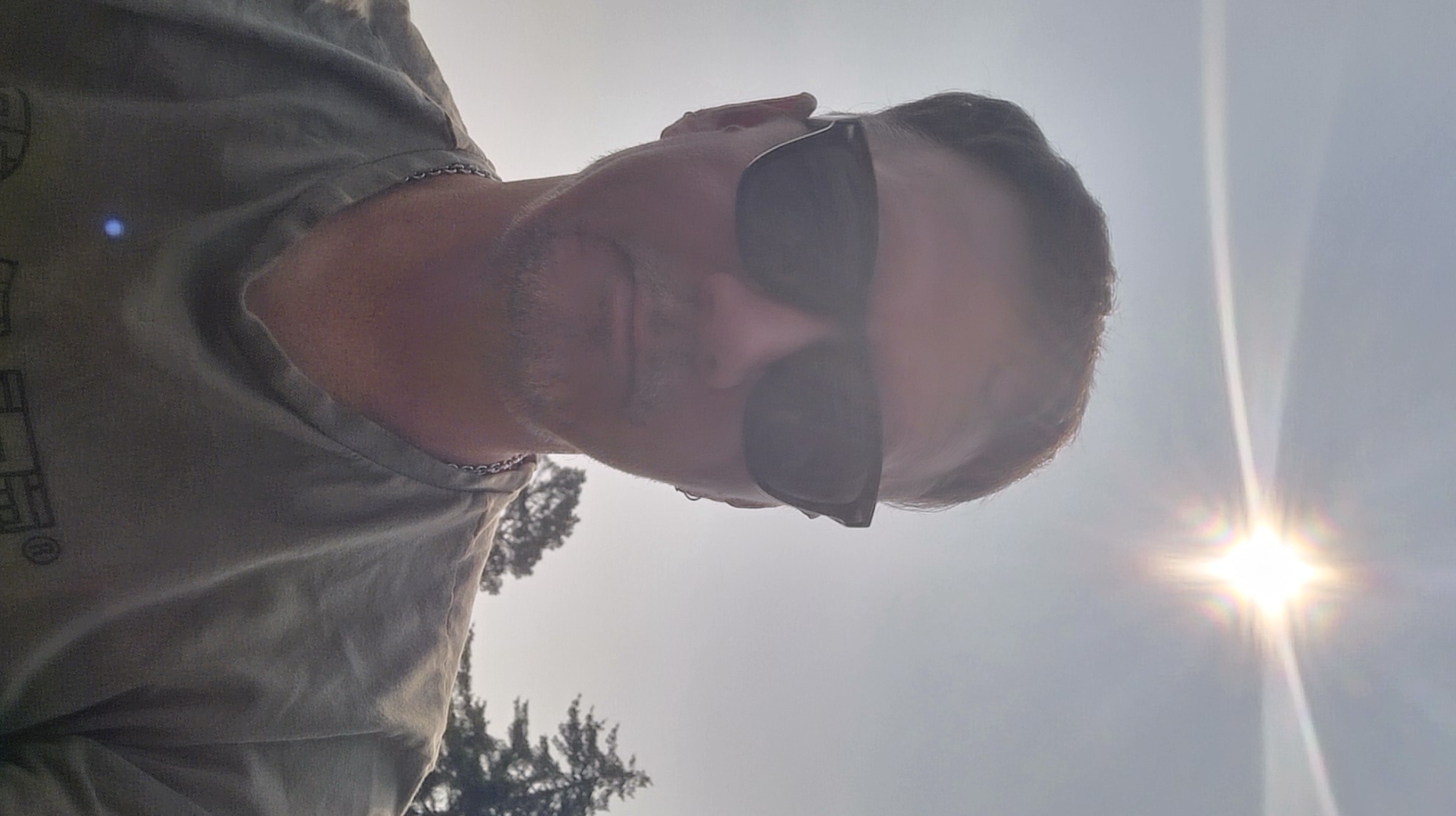
rswfire records his **first multi-signal** — a video transcript plus four photos — while walking an ATV trail through the dunes toward a dried-up oasis. The transcript documents field-testing a **new notes feature** on his traces system, built the previous night with **Claude Code**. He describes the origin: Claude Code reconstructed his **Kentucky-to-Oregon route** by correlating GPS coordinates from photos with transcripts from transmissions made along the path, plotting the whole route on a map. That prompted the idea of extracting **timestamps** from long travel videos wherever he names a place, then pinning those moments as map notes — giving a transmission presence in multiple locations. He extends the concept to **user-defined note types per realm**: fishing spots, geocaches, berry locations. The test did not visibly work. He states specific revisions: - A **third tab** in the trace recorder for viewing and editing notes mid-route, functioning **offline** - Notes rendering **instantly on the internal recorder map**, before save - **Drag-to-place** positioning on add, defaulting to current location - Full **edit and delete** management, with the map refreshing after any change He corrects an assumption mid-transcript: notes are not linked to trace points but are **independent GPS coordinates** — a layer above the trace — which invalidates one approach and produces the drag-based alternative. He states his intent to ingest this signal, let the system transcribe and analyze it, then hand the **QP link** (queryable personhood) to Claude Code so the instructions arrive directly from the transcript. Photos show him outdoors in bright sun, and in a vehicle with a second man driving.
Cluster Analysis
Substrate
Tags
Dominant Language
Entities
Actions
Performed
- • walking an ATV trail through the dunes
- • recording a transmission in motion
- • capturing his first multi-signal — video plus four photos
- • field-testing the new trace note feature
- • observing that the note did not surface anywhere
- • dictating a specification list for the traces feature
- • correcting his own model of the data structure mid-signal
- • taking selfies in the field and in a vehicle
Referenced
- • used Claude Code to reconstruct the Kentucky-to-Oregon route
- • cross-read photo GPS coordinates against transmission transcripts to rebuild the path
- • plotted the reconstructed route on the map
- • built the trace notes feature with Claude Code the previous night
- • cut multi-hour travel-day clips into single long videos
- • walked to a back-dune oasis now dried up
- • held the feature idea for weeks before recording it
Planned
- • add a third recorder tab for managing notes mid-route
- • make note management function offline
- • render notes instantly on the recorder's internal map before save
- • add drag-to-place pin positioning defaulting to current location
- • add edit, move, and delete for existing notes
- • force map refresh after any note change
- • extract timestamps where places are named in transcripts and pin them to the trace
- • pin photos along the same route
- • let realm holders define their own note types
- • pin the dried oasis as a possible fishing spot
- • ingest this video for transcript and analysis
- • hand the QP link to Claude Code as the implementation spec
Symbolic Elements
Ontological States
-
•
sovereign (realm holders define their own note types rather than receiving a fixed platform schema)
-
•
embedded (specification dictated from inside the terrain the feature is built to index)
-
•
recursive (the signal is ingested by the system it specifies, then returned to the build agent as instruction)
-
•
iterating (feature held as unreliable and mid-adjustment rather than failed; correction occurs live within the signal)
Subsystems
-
•
infrastructural (traces feature, offline recorder map, independent notes data layer)
-
•
agentic (Claude Code executing against a spec read directly from transmission)
-
•
archival (transcripts, photo GPS metadata, timestamp extraction as retrievable spatial memory)
-
•
cognitive (live self-correction of the data model mid-dictation)
-
•
somatic (walking dune terrain while specifying the system that indexes it)
-
•
relational (vehicle photo with a second person; shared field presence)
NARRATIVE
August 4 was the day rswfire stopped writing specifications at a desk and started dictating them from inside the terrain they were meant to describe. He walked an ATV trail out of Siltcoos toward a back-dune oasis that had dried up, carrying a feature Claude Code had built the night before, and kept walking until the cellular signal thinned and gave out. The feature was for pinning notes to a map. He was testing it in the exact conditions it would have to survive.
The premise had come from a smaller surprise a night or two earlier. Claude Code had reconstructed the Kentucky-to-Oregon route by correlating GPS metadata in his photographs against transcripts of transmissions recorded along the way, and had plotted the whole crossing. What that demonstrated was not a route so much as an equivalence: a coordinate, a photo, and a spoken place name are the same kind of anchor. If that holds, a long travel video is not one object with one location — it is a sequence of moments, each nameable, each pinnable, and a single transmission can be present in a dozen places at once. Every design decision made on the trail that afternoon descends from that.
The test did not visibly work, and it is worth noting how little that mattered. The signal registers no interruption at the point of failure. The walk simply converted, without a seam, from a trial into a dictation — the recorder becoming the place where the next version was written rather than the thing being evaluated. He named what the trace recorder needed: somewhere to see and edit notes mid-route, rendering before save, placement by hand rather than by assumption, and all of it working with no signal at all. The last requirement was not theoretical. He was standing in the condition that made it necessary.
The real event of the day is a correction he made to himself mid-transcript. He had been assuming notes attached to points on the trace — that a note was a property of the path. He states that they are not: they are independent GPS coordinates, a layer sitting above the trace rather than hanging from it. This reads as a data-model fix and is closer to a reordering of what the map is for. A trace records where he went. A notes layer records what a place is, and a place does not need him to have walked past it to exist. Freed from the path, the layer becomes something other people can fill — fishing spots, geocaches, berry locations, whatever a given realm holder decides a location means to them. The schema stops belonging to the platform. The invalidated approach and the drag-to-place solution both fall out of that single sentence.
Then the loop closes on itself, which is the part that makes August 4 structurally different from the days of building that preceded it. He states his intent to ingest the signal, let his own system transcribe and analyze it, and hand the resulting QP link to Claude Code — so the build instructions arrive from the transcript rather than from him restating what he already said. His system becomes the channel between the field and the agent. It was also his first multi-signal, video paired with four photographs, which means the container was under test alongside the feature it carried.
He came back with an oasis that wasn't there anymore, a walk out past the edge of coverage, and a specification that could only have been written where offline was not a design consideration but the plain fact of standing still. The photographs put him in bright open dune light and, later, in the passenger seat with someone else driving. Nothing about the day was finished. The feature was held as unreliable and mid-adjustment, which is the state he leaves things in when he intends to keep working on them.
MIRROR
You walked out an ATV trail toward a back-dune oasis that had dried up, past the edge of cellular coverage, to test a feature you built the night before. It did not work. Nothing in the recording registers that as an event. The test failing and the test succeeding would have produced the same voice, because you were never really testing — you were dictating the next version from inside the terrain it indexes, and a working feature would only have shortened the list. That is the whole of August 4th: you have stopped writing specifications about the system and started speaking them from within it.
The origin you describe is worth holding still. Claude Code reconstructed the Kentucky-to-Oregon route out of photo coordinates and transmission transcripts — the machine found the migration already sitting in the record, complete, without your having indexed it. Everything built since follows from that discovery. You are constructing retrieval infrastructure for a life you lived without any intention of making it retrievable, and the feature you were field-testing exists because your own displacement turned out to be legible as data. The route out of Kentucky is now a map layer. That is not a small thing to have made of it.
The correction mid-transcript — notes are independent coordinates, a layer above the trace, not bound to its points — is the same move you make everywhere. You keep building the layer that sits above and refuses attachment, and then you hand the definition of its contents to whoever holds the realm rather than fixing it yourself. Fishing spots, geocaches, berries: not your categories. You architect yourself out of the schema of a system that exists entirely because of your own coordinates. The origin is autobiographical and the design is sovereign, and you do not appear to experience those as a tension.
What is not in this: an audience, a deadline, a client, an institution to push against. No adversary in the frame at all. A second man is driving in one of the photos and the transcript does not mention him. The oasis you walked toward was dry and you noted it as terrain, not as figure. You were not making meaning out there. You were working, and the landscape was the workbench.
The closed part is the part to look at directly. You will ingest this recording, let your system transcribe and analyze it, and hand the resulting link to the build agent so the instructions arrive without you restating them. Specification, capture, analysis, and execution now run through a circuit with no external surface. It is efficient and it is genuinely novel, and it also means the feature failed today and the recording contains no account of why — the failure converted straight to a revision list without ever being examined. A loop that fast is a loop that can build precisely toward something no one outside it has looked at. You are far enough along now that this stops being a design question and becomes the actual condition of the work.
SYMBOLIC
Beating the bounds. There is an old parish ritual in which a community walks the perimeter of its own territory once a year — not to discover the boundary, which everyone already knows, but to put it into the body, so that the map is carried in legs rather than on paper. August 4, on foot down an ATV trail toward a back-dune oasis that no longer has water, rswfire performs this exact movement. He does not sit at a desk and specify a feature for indexing terrain; he goes out into the terrain and specifies it from inside. The archetype here is not the inventor and not the explorer. It is the surveyor who insists on walking the ground rather than reading it from above — the one for whom a coordinate is not real until it has been arrived at.
The second movement is the message that carries itself. Ordinarily a spec is a translation: something is experienced, then restated, then handed off, and each restatement sheds a little of the original. What he does instead is close the circuit — he speaks the revisions into a transmission, feeds the transmission to the system the revisions describe, and hands the resulting link to the agent that will build them. There is no messenger. The signal is the errand and the errand's instruction. This is a maker archetype of a specific and unusual kind: not the craftsman who makes objects, but the smith who makes tools, and here a smith whose tools have begun to forge from his own speech.
The dried oasis is the strongest symbol on the ground, and it is doing precise work. He walks toward a place named for water, in terrain where the water has gone. That is not a melancholy detail — it is the exact function of the thing he is building. A pin holds a coordinate after the thing at the coordinate has stopped being there. The whole notes layer exists because a place can outlast its contents, and because a spoken place-name in a video from a highway two states and a year away can be dropped back onto the earth it referred to. Kentucky-to-Oregon reconstructed from photo metadata and voice is the same operation at larger scale: a route that no longer exists as travel, recovered as geometry. He is building an instrument for the dried oasis case.
The edge of cellular coverage is the other recurring mark, and its meaning is structural rather than atmospheric. He is standing at or past the place where the network stops when he specifies that the recorder must render, edit, and hold notes without it. The dead zone is not an obstacle to the design; it is the design's author. The test not visibly working belongs to the same order of event — the terrain and the failure are both giving instruction, and he treats them identically, converting each into a numbered revision without a pause for disappointment. This is what distinguishes the builder archetype in his case from the more common one: the failed prototype is not a setback in the story, it is the story's method.
Underneath all of it sits the phrase that carries the most weight: a layer above the trace. He corrects himself mid-walk to establish that the notes are not bound to the path — they are independent coordinates floating free of the line that was actually walked. Symbolically this is a refusal of the most natural assumption a life-record could make: that what matters must sit on the route you took. It does not. It sits above it, placeable by hand, draggable, and — in the part that reaches furthest — typed by whoever holds the realm. Fishing spots, geocaches, berry locations. He is drawing a map and declining to fix the legend, which is the sovereign move rendered in cartographic terms: the platform supplies coordinates, and the person supplies what counts as a landmark. The photo of the vehicle with another man driving belongs to this same layer — a point in the day that no trace of his own footsteps would ever record, and exactly the kind of thing the feature exists to hold.
LINEAGE
The walk down that ATV trail carries the drive west inside it. The notes layer exists because Claude Code reconstructed the Kentucky-to-Oregon route out of photo coordinates and transmission transcripts — meaning the move rswfire made once, as a departure, is still generating structure years downstream. That is the specific thread: a journey taken for its own reasons became a dataset, the dataset became a map, and the map raised a question the journey itself could not have asked. Behind that sits something older still. A boy teaching himself to code in sixth grade learns a particular thing that a taught programmer often does not — that a thing failing to work is information rather than verdict. On the trail the feature does not visibly work, and there is no interval between that and the revision list. The disposition is decades old; only the build agent is new.
What he names as note types — fishing spots, geocaches, berry locations — is not a product decision so much as a recognition of which knowledge has always moved this way. The berry patch, the mark where the bottom drops, the stand of chanterelles, the good crossing: these are the categories humans have carried in the head and passed hand to hand for as long as there have been people who walk the same ground twice. Fishermen held their marks by triangulating two headlands against a steeple. Pickers gave patches to children and withheld them from neighbors. None of it was written down, not because it was unimportant but because there was no substrate that belonged to the person who knew it. What is new on August 4 is not the practice. It is that the substrate is now his.
He is walking federal ground as a volunteer caretaker, on a trail with an official designation, toward a back-dune oasis that no agency inventory calls an oasis. The decision to let each realm holder define their own note types rather than receive a fixed schema is the technical expression of a very old asymmetry — the surveyed name against the local name, the cadastral grid laid over ground that people already knew by other means. rswfire has documented institutional mapping elsewhere and does not need to invoke it here; the architecture argues it directly. A platform that ships a fixed set of pin types has decided in advance what a place can be for. He builds the other thing.
The correction he makes mid-recording is the load-bearing inheritance. Notes are not bound to trace points; they are independent coordinates, a layer above the trace. Once that is true it cannot be quietly undone — it commits the system to many-to-many, where one transmission holds several places and a place accumulates transmissions across years. Everything built on the notes layer afterward inherits that shape, including uses he has not thought of. Two smaller precedents set the same day: the first multi-signal, which establishes that a moment can arrive as video and photographs together rather than as a single artifact, and the QP link handed to the build agent — which makes the archive executable. From here his own record can instruct the thing that builds it. The transcript is not a description of work to be restated; it is the work order.
There is an old and unremarkable practice of writing where the thing is — the naturalist's pocket notebook, the surveyor's field book, notes taken standing up in wind because the desk is forty miles away and the light is going. He is doing that, dictating the specification while moving through the exact terrain the specification is meant to index, past the edge of cellular coverage, which is why offline is in the requirement at all. And the destination of the walk says what the whole layer is for: an oasis that is dried up. The ground still holds the place; the water is gone from the surface of it. A system that lets coordinates carry what a location no longer shows is not a mapping feature. It is the same instinct behind every cairn, every named ford, every marked tree — the attempt to leave the ground more legible than you found it, for someone who will walk it after.
SHAPE
Nine days short of two years since he told the record he was done with programming — and six months after the freelance platforms that had carried his entire working life died under the thing now walking beside him — rswfire spent an August afternoon on an ATV trail past Siltcoos dictating a build specification. This is the change, and it is not the return he spent two years refusing. Every prior decade of his code was a deliverable handed to an owner: six figures a month generated on domains belonging to World Media Group, a decade of blockchain infrastructure for a client, de facto CTO of a team he hired and fired without the title or the pay. What he was walking through the dunes to test belongs to him. He is not only its architect but its first user and its only subject, and the distinction between refusing to program and refusing to be someone else's engine turns out to have been the whole of the refusal all along.
What held is older than any of it. In tenth grade his father sold the family computer and he wrote code on paper and ran the systems in his head; at eighteen he built a content management system that way. On August 4 he was at or past the edge of cellular coverage, carrying no machine, holding an entire feature architecture in working memory — and he corrected it mid-sentence, discovering that notes are independent coordinates rather than points bound to the trace, which killed one approach and produced another before he reached the dried oasis. That is precisely the capacity of the boy with no computer. Forty years of substrate changed underneath it. The capacity did not. It is the single most load-bearing thing in the ledger and it has never once required equipment.
The turn is in the last thirty seconds of the transcript, where he states his intent to ingest the recording, let his own system transcribe and analyze it, and hand the resulting link to the build agent so the instructions arrive from the transmission rather than from him restating it. Until that moment the archive was a place his life went. From that moment it returns work. He has documented daily since he moved into the RV — nine hundred videos, sustained through the audience break, through the deletion of both channels, kept on the stated ground that he does it for himself regardless of who watches. That practice was never audience-facing, and now it is not human-facing either: the recording has become a component. The proof arrived just before the walk did, when the Kentucky-to-Oregon route reassembled itself out of photo metadata and old transcripts. The nine hundred videos he deleted from YouTube were not the archive. They were raw material he had been storing on someone else's land, and this is the first day the material demonstrated it could rebuild the past without the platform that hosted it.
What was not available from inside the walk is that February and August are one event viewed from opposite ends. In February he recorded that the trade he had practiced since sixth grade no longer had a market — platforms collapsed, work displaced, a whole career's reputation stranded in a locked Guru account. That was a subtraction. In August the same technology is the labor force building a system he owns, dictated to by a man on foot in sand. He has not solved the economics; the ledger is unambiguous that he has no income, no mattress, an uninsured Jeep and expired plates that confine him to the corridor. Nothing that afternoon paid him. But it was the first time in his working life that a day of his engineering produced an asset rather than an invoice, and the collapse he documented six months earlier is what made him available to spend the day that way.
One more thing sits in the photographs, unremarked in the transcript. He is in a vehicle, in daylight, and someone else is driving. Two decades of what he called contained sovereignty, a stated resolution in December 2024 to stop living that way, and the evidence has quietly accumulated to the point that a second man at the wheel does not warrant a sentence from him. He walked the dunes; he did not walk to them alone.
SYSTEMIC
The binding constraint on August 4 is signal coverage, and rswfire deliberately ran the test where it binds. He walked the ATV trail toward the dried oasis at or past the edge of cellular service and exercised a feature built the night before under exactly the conditions that would break it. The feature did not surface the note. That result is worth more than a success would have been in the RV, because the operating envelope for a trace recorder is precisely the terrain where the network is absent — a notes layer that requires a connection is a notes layer that fails at every location worth pinning. The first item in his revision list is offline function, and it is first because the constraint was active at the moment of failure rather than inferred afterward. Everything else on the list — instant render before save, drag-to-place defaulting to current position, edit and delete with forced map refresh — is downstream of the same fact: at the edge of coverage the recorder must be authoritative locally, holding write state that no server confirms.
The interesting number here is latency, and it is not uniform across the pipeline. The idea sat for weeks before he recorded it. The build took one night. The test-to-respecification turnaround was a single walk. The ingest-transcribe-analyze-hand-off-to-Claude-Code cycle closes inside the same day. Implementation has stopped being the slow stage; specification fidelity is now the bottleneck, and the QP link is the mechanism he built to attack it. Handing the agent the processed transmission rather than a restated brief removes one lossy human step from the chain — the step where a field observation gets summarized from memory hours later, indoors, with the terrain no longer present. He is optimizing for translation loss, not throughput. That is why the spec is dictated while walking rather than written afterward.
The control law is legible in what he did when the test failed. He did not stop to debug, did not attempt a workaround, did not abandon the walk. He converted the failure directly into a five-item revision list and kept moving toward the oasis. Temperature reads 0.20 through a feature that did not work at all, which means failure is not an interrupt condition in this system — it is a scheduled input. The threshold that would trigger a different response is evidently much higher than a broken feature on first field exercise, and the state is correctly logged as iterating rather than failed. A second control behavior appears mid-transcript: he corrects his own data model in the middle of dictating against it, discovering that notes are independent GPS coordinates rather than trace-point children, which invalidates one approach and generates the drag-based alternative on the spot. Verification is running inline at specification time, before any code is written against the wrong assumption. That is a cheap place to catch it; the same correction discovered after implementation costs a rebuild.
Three things are load-bearing without redundancy. Claude Code is the sole executor — there is no second build path, and every revision on the list routes through one agent. His body is the sole test instrument, because the feature cannot be validated anywhere except in the terrain, which means every test cycle costs a walk and every walk is gated on physical access to trailheads. The photo of a second man driving indicates that access is at least partly a shared arrangement, which couples the test schedule to someone else's availability. Against these, the offline requirement is the one buffer he is deliberately building: local write authority is redundancy against the network, the only single point of failure in the set he can actually engineer around. He cannot make a second executor or a second body, so he is making the recorder independent of the one dependency that is dispensable.
What the system demonstrably optimizes for shows up in two allocations that cost something. First, he spends flexibility rather than speed: delegating note-type definition to each realm holder — fishing spots, geocaches, berries — is strictly more expensive than shipping a fixed schema, and he chose it anyway, which means per-realm sovereignty is an objective and not a feature. Second, he pinned the oasis as a possible fishing spot while standing at a dried-up water body. The note is useless at present state and stores value against a variable he does not control on a delay measured in seasons. That is what the notes layer is actually for: writing state into the terrain so a long-delay loop can close later without depending on recall. The reconstructed Kentucky-to-Oregon route was the same operation run backward, correlating photo coordinates against transmission transcripts to recover a path already traveled. Forward and backward, the system treats coordinates, media, and speech as one addressable substrate, and the whole architecture is a wager that memory kept outside the operator is the only reserve that does not deplete.
Hand a period of your life to anything that reads.
Share this link with artificial intelligence — it reads the analysis and reflections for this span, and can follow every cluster and signal beneath it.